

As part of its partnership with European Space Imaging, TOPO+ is pleased to announce the availability of the ECOPIA GFX product suite to Tunisian customers.
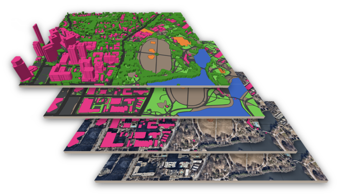
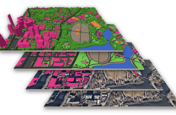
This partnership between TOPO+, Ecopia.AI and European Space Imaging makes it possible to offer vector data generated from satellite imagery. Using recent, very high-resolution satellite imagery, Ecopia relies on artificial intelligence technology to extract vector data over large areas very quickly. This reduces the human effort required and makes it possible to generate and maintain millions of km² of very high-resolution vector data for any area of the globe, with professional GIS quality at an affordable cost.

Available products include:- Building Footprints : High-precision building footprints – Roads: High-precision road network – Land Cover: High-precision 12-class land cover map On request, each of these 12 classes can be supplied individually.
Last modified: December 1, 2023